It should be obvious to you that the air we breathe circulates around the whole world.
But it’s not random. It is in patterns which
can be identified.
These are winds that cover large areas over the Earth’s surface. There are three global wind systems:
• The tropical easterlies
• The westerlies
• The polar easterlies
A force called Coriolis force causes global winds to move to the left in the southern hemisphere and to the right in the northern hemisphere.
This tri-cellular arrangement, the pressure belts and the global winds together form the global air circulation. This is shown below.

Cyclones (1)
Mid-latitude cyclones
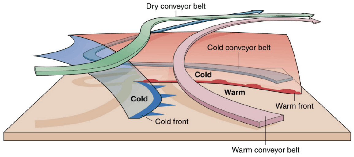
In this section, we look at mid-latitude cyclones in detail. We will focus on the cross-section through a mature mid-latitude cyclone and the weather that occurs as a result of the cold front.
The picture below shows a cross-section through
a mid-latitude cyclone.

As a mid-latitude cyclone moves towards (in this case) South Africa, it is the cold front that mostly affects our weather.
Weather
in front of the cold front (see
where the number 1 is, in the picture
above):
• Cool temperatures
• Very low pressure
• Overcast conditions, cumulonimbus clouds
• Thunderstorms
Weather
behind the cold front (see
where the number 2 is, in the picture
above):
• Cold temperatures
• High pressure
• Partly cloudy conditions, cumulus clouds
• Light rain
Note that as a mid-latitude cyclone moves from west to east, we experience the warm air mass in front of the cold front first, then the air behind the cold front. This can be seen in the picture above as you move over from point 1 to 2.


Those are just pictures but here’s a satellite image of a mid-latitude cyclone.

Cyclones (2)
Tropical cyclones
A tropical cyclone is a type of low pressure
system which generally forms in the tropics
(between 5°C and 30°C North and South).
They are accompanied by thunderstorms and a
circulation of winds near the Earth’s surface,
which is clockwise in the southern hemisphere
and counter-clockwise in the northern
hemisphere.
Tropical cyclones are also known as
hurricanes in America;
typhoons in China and Japan;
and willywillies in
Australia.
Tropical cyclones are given names
alphabetically within the season in which they
occurred. For example, ‘Alfred’ will denote that
it is the first tropical cyclone to occur in
that season.
We will now look at tropical cyclones in more detail by focusing on the cross-section through a mature tropical cyclone.
In order for the tropical cyclone to occur
there should be:
• temperature of 27°C and more
• Coriolis force
• enough moisture
• less function
This picture shows a cross-section through a
tropical cyclone.

You might know from films, that as a cyclone approaches, the winds get stronger and stronger; when the eye of the storm is over you, there is no wind at all and no rain!
And then comes the other side of the cyclone,
and the winds get stronger and the rains get
heavier until the whole thing passes by.
There are even people who live this type of weather, and those people are called ‘Stormchasers’.
Here’s a chart of the differences between mid-latitude and tropical cyclones.

Here’re two synoptic maps of the two types of cyclones.

