On all maps there is some indication of the directions - the Cardinal directions.
Sometimes, the compass rose is only small,
sometimes it is very plain and simple, sometimes
it is very fancy.
But somewhere, the directions are indicated and
that is very important because the people using
the maps need to know in which direction the
weather is moving.
On any map, close up, you MUST know which
direction the map is orientated.
Sometimes the map is such a large scale
(concentrating on a mall area) that there's no
coastline or shape of land to show you which way
is north.
That is why a compass rose is extremely
important on a map, whether it is a normal map
or a synoptic map.
Just like you need to know the magnification of
a picture of skin - it could be rock, stones etc
but if you know it is a microscope picture, you
can orientate your mind to appreciate and know
what you are looking at.
Ok, so knowing the direction of weather cells
and how maps are orientated is vital when
dealing with the weather, or even going on a
trek.
Thinking again about a synoptic map, how do
you think the weather people get to know all
those lines and numbers?
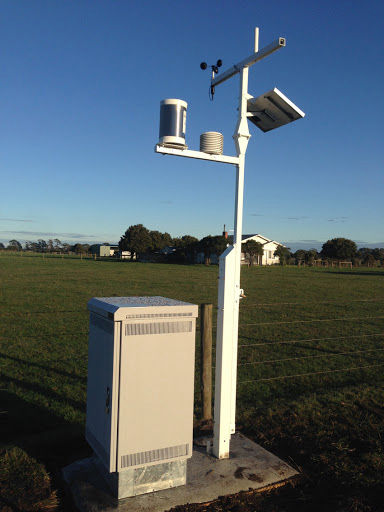
Here is a weather station in the country, but sometimes we also see them along the roads in Bangkok. those measure pollution, but the ones shown in the picture measure rainfall, atmospheric pressure, humidity and windspeed.
From a network of those small weather stations,
the weather people (we used to call them
'weathermen') collate all the data and can make
the appropriate maps.
'Collate' means to gather together
information.
These days, a computer or two does it all, and produce the maps we see on the TV, BUT the weatherman still has to create those maps from the data in the computer.
Here is a smaller weather station.
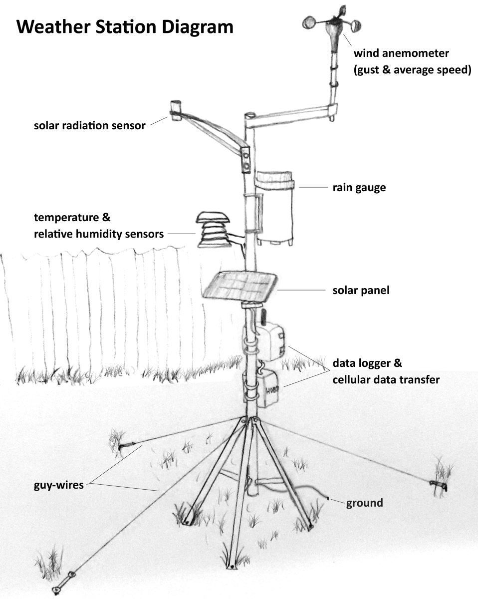
At the top you can see an anemometer ... which measure the wind speed, either average or in gusts; there's a solar radiation sensor (which measures the amount of radiation received); a rain gauge (which catches rain ...) and then temperature and humidity sensors.
These instruments need power, so there's a
solar panel, which provides that power. Even in
cloudy places, the solar panel is able to gather
enough of whatever it use to provide power for
the weather station.
Then come the data logger and cellular data
transfer units, which collect transit the data
to the base station.
There are guy wires to hold the whole thing in
position and a 'ground' wire.
Guy wires are also used to hold tents up.
People often call them Guide Wires but that's
not correct.
What does the 'ground' wire do?
Everything metal collects static electricity,
and that excess electricity would cause false
readings if left hanging about on the
machinery.
So, the ground wire harmlessly allows any
excess electricity to have a path into the earth
where it dissipates.
Use Line, Facebook, email or IG
